PCT Section K Southbound – Day 5 – Lake Aloha to Echo Lake Chalet and end of hike 7/19/24

Friday, July 19, 2024

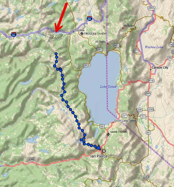
6 miles – PCT mile 1099.5-1093.4

Last day! So of course I got lost. I headed out of camp after saying goodbye to the friends I had made the night before and just walked off into the woods.

Once I found my way back to trail, I hiked on toward civilization. Lake houses became more frequent and sweet-smelling day hikers were passing me coming from the other direction. A couple of hours later, I arrived at Echo Lake Chalet, put my pack down, and went inside to get a snow cone for breakfast. This was the end of Section K of the PCT. 65 miles total.

End of Trail

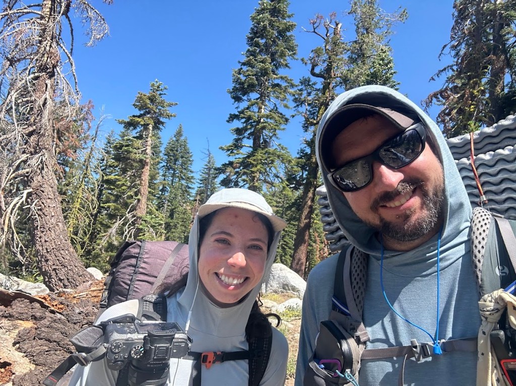
I was happy and exhausted. My trail angel, Madison (Buffer, PCT Class of 2023, just like me), that I had also met at Trail Skills College before the hike, picked me up and drove me to her house in South Lake Tahoe. She and her boyfriend Shawn (Sean?) pampered me and were a blast to hang out with. He likes Star Wars more than almost anyone I’ve ever met and we got along great.

COMFY bed

Unfortunately, I found out that I had apparently done this entire hike while infected with Covid.

I had started feeling kinda crappy from day one and just pushed through the miles anyway. The daytime wasn’t bad, but at night I would get a super stuffy nose and was definitely coughing the entire hike. I think I may have had fever that night after the 21 mile day.

But I figure I’ve had worse and proved to myself I can take on a solo hike for a week, sickness and all, and do ok. I’m pretty tired of carrying a bear can and would like to not do that on whatever section of the PCT I tackle next.

The next morning, they drove me to Harrah’s in Stateline to pick up the shuttle bus back up to the Reno airport where I met Rayna again to grab my suitcase and headed back to Texas. Great hike. 10/10, would do again.

PCT Section K Southbound – Day 2 – Trail Camp to Five Lakes Basin 7/16/24

Tuesday, July 16, 2024

8 miles – PCT mile 1145-1137

I didn’t go nearly as far as I should have on this day, but sometimes water sources and terrain dictate the day, rather than a mileage goal. It was totally worth hanging out at Five Lakes for a couple of hours to swim.

I woke up and was packed and on trail just after 7am as the sun was starting to peek over the peaks.

I would find my bug net later, don’t worry
favorite trail snack
silent and beautiful

I would soon reach the boundary of the Granite Chief Wilderness, one of two wilderness areas I would hike through on this trip. Wilderness areas were first designated by the 1964 Wilderness Act (click this link for more info).

An excerpt from that act: “A wilderness, in contrast with those areas where man and his own works dominate the landscape, is hereby recognized as an area where the earth and its community of life are untrammeled by man, where man himself is a visitor who does not remain.”

No motorized equipment of any kind (chainsaws, ATVs, etc) are allowed in wilderness areas, meaning any trail maintenance has to be done purely by hand.

Granite Chief Wilderness
one of my favorite pics of the whole hike
I ran into a Nobo hiker named Hummingbird! I had to pose with my trail doppelganger
the trail in this section has endless fields of Wooly Mule’s Ears plants

I hiked on and got to the 5 Lakes Basin early in the afternoon, where I decided it was time to swim. I couldn’t camp right by the lake, but it was worth the .2 mile detour.

arriving at 5 Lakes Basin
Swim!
Ducks!

Once I was done with my swim I headed back to camp and realized I had only gone 8 miles today, instead of my intended 12-15, which threw me into a momentary panic about mileage. I was faced with a 1000 foot climb out of camp and no water for several miles if I were to continue today. After a campsite mate talked me down from the ledge, I realized I would just have to push mileage a bit more than I wanted the next couple of days to get back on track. I settled in for the evening and prepared for a long day tomorrow.

PCT Section K Southbound – Day 1 – Donner SNO Park to Camp 7/15/24

Monday, July 15, 2024

13 miles – PCT mile 1157-1145 (plus one mile from SNO Park to PCT junction)

For reference, here is the map of my track over the whole hike, which took four and a half days. For some reason it didn’t start tracking until a little ways in, but I actually started at the red arrow (I-80).

First day on trail! My pack was HEAVY with a full bear canister and 2.5 liters of water. No stove though!

My trail angel from the PCTA Trail Skills College, Abel, drove me to breakfast and then the trail head. He’s from Tehachapi, CA, another trail town down in southern California and trail angels hikers all the time. Hundreds a year, he says. He has also biked across the US and climbs and hikes all the time too. He’s a great guy and I have his contact info for when I do his section of the PCT one day!

Abel

I had a mile to hike from the trail head to meet up with the PCT. Within 5 minutes I saw my first wildlife. Marmot!

such goofy creatures

I took a lot of videos on this hike to try and illustrate the trail experience a bit better.

The trail started to wind up the mountain towards Donner Ski Ranch.

I put on my sun gloves like a good husband of a dermatologist would and hiked on to the Ski Ranch.

Then I came to a very nice section of trail.

As I strolled into Donner Ski Ranch with the other hikers who were there at 9:30am, the bartender insisted on me getting the 40 oz malt liquor and I figured it was hiker tradition, so what the hell. I tried to trade it for a beer, but she said “nope, it’s the 40 at Highway 40” and that’s what I had to get. I only had the one cup and wasted the rest, but oh well.

I charged up my phone a bit and continued on trail, up a 1000 foot climb to the ridge overlooking Donner Lake that I would be on for the rest of the afternoon.

First big climb

Hey, still some snow! But not really wanting to risk the traverse.

That’s better.

I continued on the exposed ridge as clouds started to form overhead. I knew I had quite a long exposed section, so when it started to thunder, I made the call to get down off trail into some trees a couple of hundred yards below.

The rain intensified and soon became a not very fun experience. It lasted almost an hour and I had to take lightning precautions, which involved spreading out my pack and my poles away from me (metal) and also standing on my sit pad as an insulator, while at the same time keeping my body moving to avoid hypothermia as the temperature dropped probably 30 degrees and I was getting wet.

I continued on the trail being chased by more rain clouds the rest of the day, but thankfully nothing more materialized. I also got my first view of Lake Tahoe.

The hike then took me over some scree fields around Anderson Peak and Tinker Knob around 9000 feet before descending down into a valley where I would make camp.

Campsite for night one

Packing Up For Tahoe

July 11, 2024

I spent today packing up my gear and laying out my food for the next week that I will be spending in the Lake Tahoe area. My plan is to take two days on Friday and Saturday participating in a Trail Maintenance course near Truckee, put on by the Pacific Crest Trail Association (PCTA), and then hike Section K of the PCT starting on Monday morning.

For those who don’t know, the PCT is divided into sections in each state. A, B, C, etc, going from south to north. I am going southbound (Sobo) this time, but I incidentally picked a start and end point that are exactly the boundaries of Section K in California. For me, that means Donner Peak (Interstate 80) near Truckee down to Echo Summit (near South Lake Tahoe). Total mileage is right at about 65 miles.

There is a fire about 12 miles to the west of the beginning of my trail right now (Royal Fire), but the US Forest Service and firefighters have done a phenomenal job so far of keeping it contained to only a couple of hundred acres. Hoping that the wind and weather cooperate over the weekend and the PCT stays unaffected. Worst case scenario, I could probably pivot and hike part of the Tahoe Rim Trail going east, but we’ll get to that if need be.

As I said, I went over inventory and laid out my food plans today. This section of the trail requires a bear canister, by law. Basically, it’s a big plastic can filled with your food that you place a couple hundred yards from your tent when you sleep at night, instead of keeping it all in your tent like in non-bear country (debateable).

Ubiquitous hiker food layout shot

I’m guessing it’s actually a bit too much food, but we shall see. Very excited about those Walking Tamales. It’s a different thing having to fit everything into a bear canister at night and you also have to put in any toiletries, sunblock, lip balm, etc. Anything that has a scent.

So here’s my bear canister, minus a couple of items I will buy in Truckee that will make up most of my dinners (tortillas, salami, and cheese). 8.13 pounds, so far. I’m going stove-less this hike and am very excited to not have to worry about the excruciating minutiae of dealing with cooking at the end of a long day. I will eat my bars and tortillas and trail mix and be very happy.

I am typing this as I wait for my final load of laundry to be done (I won’t have a shower for 7 days after tomorrow morning) and then it’s into the mountains! It will be interesting going solo, knowing it’s only going to be for 5 days this time. I am looking forward to seeing how I react mentally. I’m going to try and only average 10-13 miles a day, so I should be able to take my time.

I will do my best to blog from the trail, but if nothing else, I will get everything up when I get back next weekend. I’m also going to try and video a lot.

Hike on!