Monday, July 15, 2024
13 miles – PCT mile 1157-1145 (plus one mile from SNO Park to PCT junction)
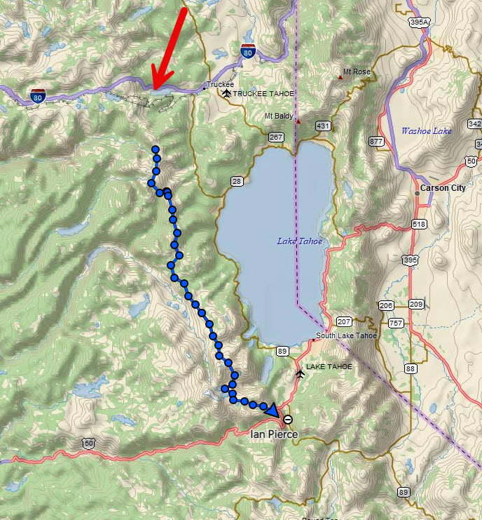
For reference, here is the map of my track over the whole hike, which took four and a half days. For some reason it didn’t start tracking until a little ways in, but I actually started at the red arrow (I-80).
First day on trail! My pack was HEAVY with a full bear canister and 2.5 liters of water. No stove though!
My trail angel from the PCTA Trail Skills College, Abel, drove me to breakfast and then the trail head. He’s from Tehachapi, CA, another trail town down in southern California and trail angels hikers all the time. Hundreds a year, he says. He has also biked across the US and climbs and hikes all the time too. He’s a great guy and I have his contact info for when I do his section of the PCT one day!

I had a mile to hike from the trail head to meet up with the PCT. Within 5 minutes I saw my first wildlife. Marmot!

I took a lot of videos on this hike to try and illustrate the trail experience a bit better.
The trail started to wind up the mountain towards Donner Ski Ranch.
I put on my sun gloves like a good husband of a dermatologist would and hiked on to the Ski Ranch.

Then I came to a very nice section of trail.
As I strolled into Donner Ski Ranch with the other hikers who were there at 9:30am, the bartender insisted on me getting the 40 oz malt liquor and I figured it was hiker tradition, so what the hell. I tried to trade it for a beer, but she said “nope, it’s the 40 at Highway 40” and that’s what I had to get. I only had the one cup and wasted the rest, but oh well.

I charged up my phone a bit and continued on trail, up a 1000 foot climb to the ridge overlooking Donner Lake that I would be on for the rest of the afternoon.
Hey, still some snow! But not really wanting to risk the traverse.
That’s better.
I continued on the exposed ridge as clouds started to form overhead. I knew I had quite a long exposed section, so when it started to thunder, I made the call to get down off trail into some trees a couple of hundred yards below.

The rain intensified and soon became a not very fun experience. It lasted almost an hour and I had to take lightning precautions, which involved spreading out my pack and my poles away from me (metal) and also standing on my sit pad as an insulator, while at the same time keeping my body moving to avoid hypothermia as the temperature dropped probably 30 degrees and I was getting wet.
I continued on the trail being chased by more rain clouds the rest of the day, but thankfully nothing more materialized. I also got my first view of Lake Tahoe.
The hike then took me over some scree fields around Anderson Peak and Tinker Knob around 9000 feet before descending down into a valley where I would make camp.


